


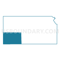
Southwest Kansas--Dodge City, Garden City & Liberal City PUMA, Kansas
About
Outline

Summary
| Unique Area Identifier | 192959 |
| Name | Southwest Kansas--Dodge City, Garden City & Liberal City PUMA |
| State | Kansas |
| Area (square miles) | 11,887.82 |
| Land Area (square miles) | 11,878.06 |
| Water Area (square miles) | 9.76 |
| % of Land Area | 99.92 |
| % of Water Area | 0.08 |
| Latitude of the Internal Point | 37.63185900 |
| Longtitude of the Internal Point | -100.80570160 |
Maps

Graphs
Select a template below for downloading or customizing gragh for Southwest Kansas--Dodge City, Garden City & Liberal City PUMA, Kansas


Neighbors
Neighoring Public Use Microdata Area (by Name) Neighboring Public Use Microdata Area on the Map
- Northwest Kansas PUMA, KS
- Panhandle & Northwest Oklahoma PUMA, OK
- South Central Kansas PUMA, KS
- Southeast Colorado PUMA, CO
Top 10 Neighboring County (by Population) Neighboring County on the Map
- Finney County, KS (36,776)
- Ford County, KS (33,848)
- Seward County, KS (22,952)
- Texas County, OK (20,640)
- Prowers County, CO (12,551)
- Grant County, KS (7,829)
- Pawnee County, KS (6,973)
- Gray County, KS (6,006)
- Stevens County, KS (5,724)
- Beaver County, OK (5,636)
Top 10 Neighboring County Subdivision (by Population) Neighboring County Subdivision on the Map
- Dodge City city, Ford County, KS (27,340)
- Garden City city, Finney County, KS (26,658)
- Liberal city, Seward County, KS (20,525)
- Guymon CCD, Texas County, OK (15,235)
- Lincoln township, Grant County, KS (7,102)
- Garden City township, Finney County, KS (5,761)
- Center township, Stevens County, KS (4,396)
- Hooker CCD, Texas County, OK (3,790)
- Sherlock township, Finney County, KS (2,789)
- North Beaver CCD, Beaver County, OK (2,698)
Top 10 Neighboring Place (by Population) Neighboring Place on the Map
- Dodge City city, KS (27,340)
- Garden City city, KS (26,658)
- Liberal city, KS (20,525)
- Ulysses city, KS (6,161)
- Hugoton city, KS (3,904)
- Lakin city, KS (2,216)
- Elkhart city, KS (2,205)
- Cimarron city, KS (2,184)
- Holcomb city, KS (2,094)
- Syracuse city, KS (1,812)
Top 10 Neighboring Elementary School District (by Population) Neighboring Elementary School District on the Map
Top 10 Neighboring Unified School District (by Population) Neighboring Unified School District on the Map
- Garden City Unified School District 457, KS (33,698)
- Dodge City Unified School District 443, KS (30,996)
- Liberal Unified School District 480, KS (21,038)
- Guymon Public Schools, OK (12,679)
- Ulysses Unified School District 214, KS (7,769)
- Hugoton Public Schools Unified School District 210, KS (5,050)
- Scott County Unified School District 466, KS (4,947)
- Cimarron-Ensign Unified School District 102, KS (3,295)
- Kismet-Plains Unified School District 483, KS (3,175)
- Holcomb Unified School District 363, KS (2,962)
Top 10 Neighboring State Legislative District Lower Chamber (by Population) Neighboring State Legislative District Lower Chamber on the Map
- State House District 64, CO (63,179)
- State House District 61, OK (34,098)
- State House District 119, KS (23,934)
- State House District 125, KS (22,636)
- State House District 115, KS (21,825)
- State House District 114, KS (21,602)
- State House District 124, KS (21,020)
- State House District 123, KS (20,756)
- State House District 116, KS (19,915)
- State House District 122, KS (19,688)
Top 10 Neighboring State Legislative District Upper Chamber (by Population) Neighboring State Legislative District Upper Chamber on the Map
- State Senate District 2, CO (125,412)
- State Senate District 1, CO (125,154)
- State Senate District 27, OK (72,228)
- State Senate District 38, KS (70,617)
- State Senate District 36, KS (68,097)
- State Senate District 39, KS (64,662)
- State Senate District 33, KS (64,554)
- State Senate District 40, KS (61,332)
Top 10 Neighboring 111th Congressional District (by Population) Neighboring 111th Congressional District on the Map
- Congressional District 3, OK (732,394)
- Congressional District 4, CO (725,041)
- Congressional District 1, KS (655,310)
Top 10 Neighboring Census Tract (by Population) Neighboring Census Tract on the Map
- Census Tract 9618, Ford County, KS (8,407)
- Census Tract 9619, Ford County, KS (8,359)
- Census Tract 9602, Finney County, KS (7,047)
- Census Tract 9659, Seward County, KS (6,803)
- Census Tract 9637, Grant County, KS (6,332)
- Census Tract 9606, Finney County, KS (5,683)
- Census Tract 9620, Ford County, KS (5,111)
- Census Tract 9571, Scott County, KS (4,936)
- Census Tract 9621.01, Ford County, KS (4,822)
- Census Tract 9660, Seward County, KS (4,789)
Top 10 Neighboring 5-Digit ZIP Code Tabulation Area (by Population) Neighboring 5-Digit ZIP Code Tabulation Area on the Map
- 67846, KS (33,696)
- 67801, KS (30,559)
- 67901, KS (22,073)
- 73942, OK (12,953)
- 67880, KS (7,878)
- 67951, KS (4,981)
- 67871, KS (4,973)
- 67835, KS (2,954)
- 73945, OK (2,889)
- 67860, KS (2,878)